
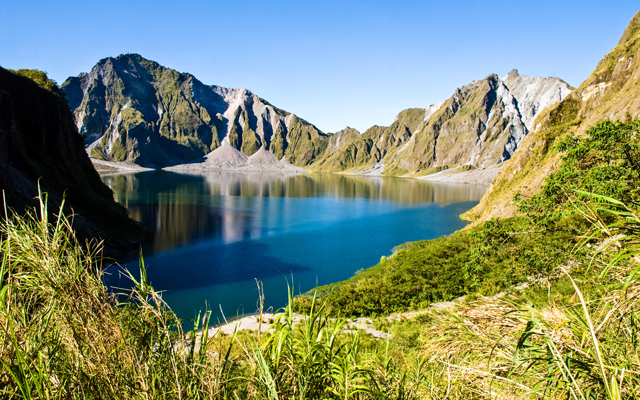
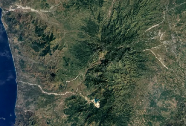
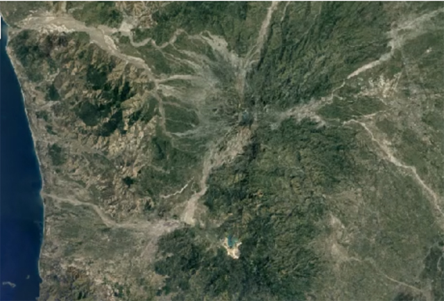
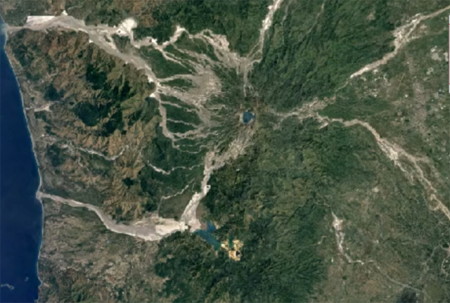
(SPOT.ph) Nature never fails to amaze us. Coasts can be reshaped by typhoons, underwater caves and rivers can form below ground, and islands can be born from a volcanic eruption. In Zambales, the beautiful Pinatubo Lake, one of the area's most popular tourist attractions, was formed after the eruption of Mount Pinatubo on June 15, 1991. And with Google Earth's new Timelapse feature, you can now see how Pinatubo Lake looked before there was even a lake.
Mount Pinatubo is an active stratovolcano straddling the provinces of Zambales, Tarlac, and Pampanga. It was pretty chill, at least until week-long activity that eventually led to the nine-hour eruption. The volcanic activity was so massive that it permanently changed the topography in that area, including the collapse of the stratovolcano inward and into the depleted magma chamber underground. This 2.5-kilometer wide caldera eventually filled with water coming from spring discharge from its walls, mountain runoff, and rainwater; it's now what we know as Pinatubo Lake—a tourist attraction that features hiking and 4x4 rides.
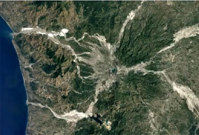
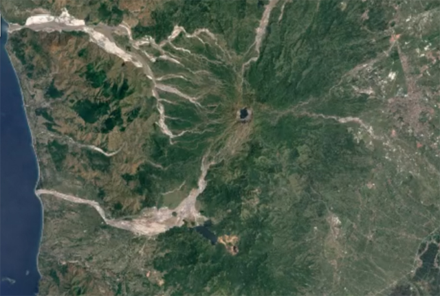
Google Earth's update lets users scan through satellite photos of a specific area year-on-year starting from 1984. It was compiled through 24 million satellite photos that were stitched together into one interactive 4D experience.
[ArticleReco:{"articles":["85952","85920","85848","85949"], "widget":"Hot Stories You Might Have Missed"}]
Hey, Spotters! Check us out on Viber to join our Community and subscribe to our Chatbot.
We are now on Quento! Download the app on Google Play or App Store and enjoy more articles and videos from SPOT.ph and other Summit Media websites.
Source: Spot PH


No comments:
Post a Comment