
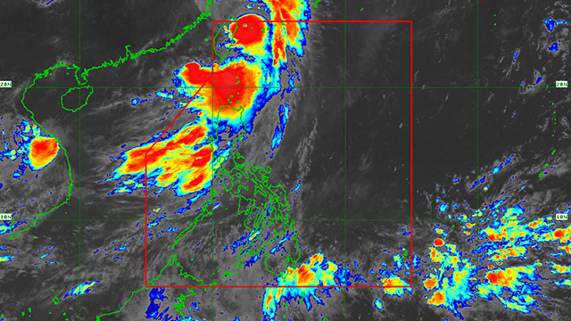
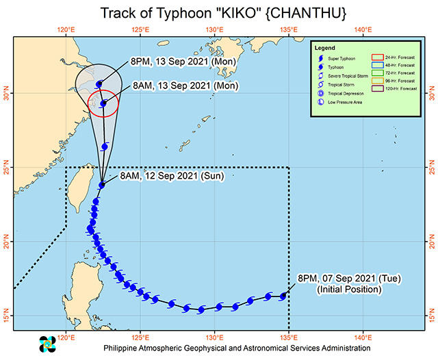
Storm signals in some areas in Northern Luzon were downgraded on Sunday, September 12 as Typhoon Kiko (Chantu), the country's strongest storm so far this 2021, moved out of the Philippine Area of Responsibility, said the Philippine Atmospheric, Geophysical, and Astronomical Services Administration.
At 4 a.m., Kiko was spotted 245 kilometers north of Itbayat, Batanes and has slightly weakened, packing maximum sustained winds of 175 kph and 215 kph.
Signal No. 2 (61 to 120 kph winds) is still up over the northern portion of Batanes (Itbayat), where winds could cause light to moderate damage to high-risk structures, while old, dilapidated structures or makeshift shanties may be damaged or unroofed.
Signal No. 1 (30 to 60 kph winds) remains hoisted over the northern portion of Babuyan Islands and the rest of Batanes, which could cause light to medium damage to low risk structures, and slight damage to houses made of very light materials in exposed communities.
Heavy to intense with at times torrential rains are expected over Batanes in the next 24 hours, while moderate to heavy rains are also likely over Babuyan Islands.
Typhoon Kiko will also continue to enhance the Southwest Monsoon, causing rains over Ilocos Region, Cordillera Administrative Region, and the western section of Central Luzon.
Kiko is expected to exit the Philippine Area of Responsibility on the afternoon or evening of September 12, but will remain within typhoon category.
Hey, Spotters! Check us out on Viber to join our Community and subscribe to our Chatbot.
Source: Spot PH


No comments:
Post a Comment